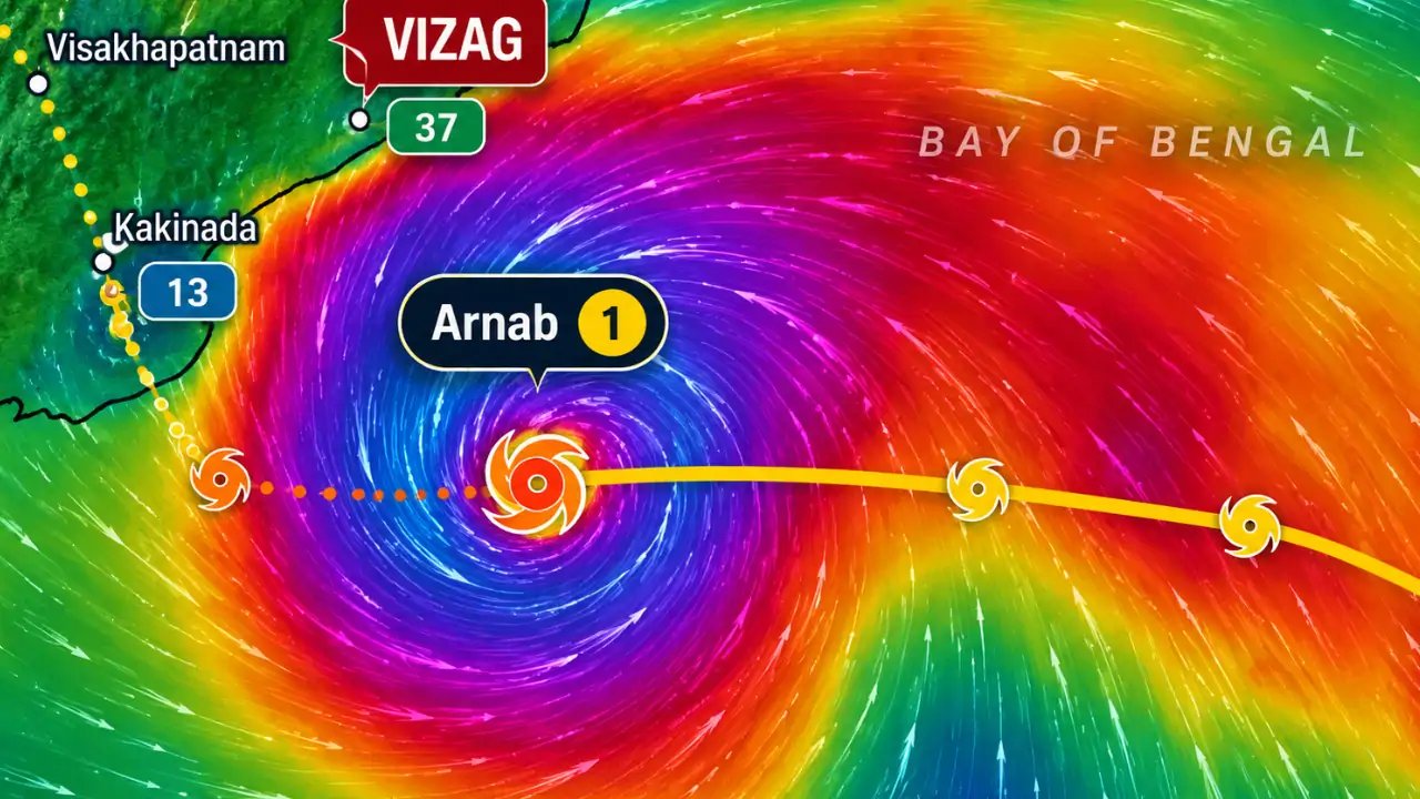
Cyclone Arnab, first classified as a deep depression on Oct 26, has now reached very severe status, its center located roughly 300 km southeast of Visakhapatnam and 460 km east of Machilipatnam as of 5:30 AM on Oct 27.
The IMD reports the storm is advancing west‑northwest at 22 km/h, a steady pace that has kept it on a trajectory toward the Andhra coastline. It is expected to shift northwest later in the day before making landfall.
According to the Andhra Pradesh State Disaster Management Authority, the cyclone will first bathe the northern coastal districts between Bapatla and Visakhapatnam, where heavy rainfall and wind gusts up to 140 km/h are anticipated. Prakhar Jain, APSDMA Managing Director, urged residents to stay alert and secure property.
Local fishermen in Bapatla have already begun tightening nets and moving boats to safer harbours, while families in Srikakulam district report that power lines have been knocked down by earlier squalls. The cyclone’s path has prompted a state‑wide evacuation order for vulnerable low‑lying villages.
Officials say the storm’s passage could result in up to 10 cm of rainfall over the coast, potentially flooding roads and disrupting the region’s fishing economy. The IMD has issued a warning for the next 24 hours, with a focus on minimizing damage once the cyclone makes landfall.
The next critical step is the cyclone’s actual impact on the coastline tomorrow morning. Authorities are preparing emergency shelters and coordinating with the navy for potential rescue operations as the storm approaches the shore.