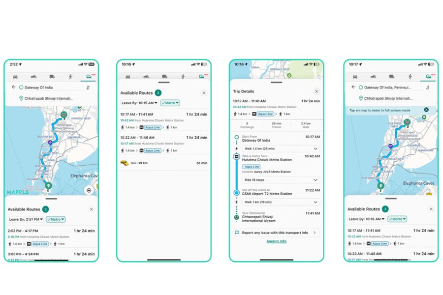
Mappls App now pulls official Mumbai Metro Line 3 data – geotagged station locations, parking options, line colours, interchange details, train frequencies and fare prices – into its routing engine.
R. Ramana, MMRCL’s Director of Planning & Real Estate, said the move is aimed at making metro information more accessible, while Rohan Verma, Joint Managing Director of Mappls, highlighted the app’s ability to let users plan end‑to‑end journeys that weave in metro legs without leaving the interface.
Drivers already rely on Mappls for road navigation; adding public‑transport layers means they can see when a metro train is due, how much it will cost, and whether a station offers two‑wheeler or car parking—all in one glance.
Compared to Google Maps, which offers generic transit overlays, Mappls now delivers granular, line‑specific data straight from MMRCL. Citymapper and Moovit also provide transit routes, but neither has the official fare tables or real‑time frequency feeds that Mappls imports from the Mumbai Metro Authority.
The integration signals a broader trend: navigation platforms are becoming multimodal hubs, blending road, bike, and public‑transport routes into a seamless planning experience. In a country where 45 million Metro users rely on accurate travel data, this partnership could set a new industry standard.
The deal kicks off with Line 3; MMRCL and Mappls indicated plans to roll out other metro lines in Mumbai and eventually other cities once the data pipelines prove robust. For the near future, users can expect a smoother commute to Line 3 stations, while automotive enthusiasts will watch how in‑car infotainment systems adapt to incorporate these richer transit overlays.